
What You'll Learn
Oregon Tech will give you the skills to be a land surveyor and/or geospatial professional by learning through using high performance geographical equipment and systems to analyze the great outdoors.
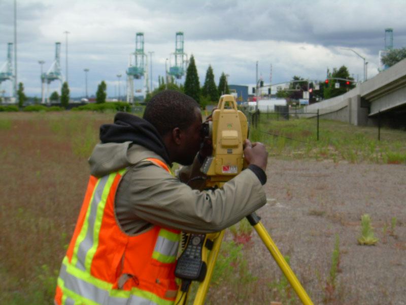
At Oregon Tech, the study of Geomatics combines theory, problem-solving and field work to train students for an exciting career.
The Geomatics program has two options for students to specialize in: Surveying or Geographical Information Systems.
Students who choose the Surveying Option will:
- Use computer systems and equipment to find and define property lines.
- Plan out subdivisions to make creative and effective designs.
- Map boundary limits and learn how to write deed descriptions relative to property boundaries and more.
The land surveying option prepares students to pass the Fundamentals of Surveying (FS) examination and pursue licensure as a registered Professional Land Surveyor (PLS). Applicants to the online Surveying option must be a surveyor actively working in the field under the supervision of a licensed surveyor.
Students who choose the GIS Option will:
- Map and geodatabase topology.
- Learn how to program functions and procedures into geographic information systems.
- Study the Earth's shape and how to project 2D and 3D maps onto its surface and more.
The GIS option prepares students to become geographic information systems professionals. All students learn the professional responsibility of protecting the health, safety and welfare of the public, and become aware of the global and cultural issues related to their discipline.
Courses
Students have one-of-a-kind opportunities for projects in their courses. Geomatics students have been asked to find and define property lines in town, survey new territory like rivers and canals and create needed maps for purposes like emergencies and events.
Geomatics majors typically take courses in:
- Field Surveying
- Computer Programming
- Geographic Information Systems
- Global Positioning Systems
- Satellite and terrestrial remote sensing
The program also offers coursework in the more traditional areas of surveying, including boundary law, construction surveying, and computer-aided drafting.

Jobs and Careers in Geomatics
Today, geomatics professionals use an integrated approach to measuring, analyzing and managing spatial data, employing high-tech equipment like Geographic Information Systems, Global Positioning Systems (GPS), digital photogrammetry, digital total stations, satellite and terrestrial remote sensing to create a detailed but understandable picture of the Earth's natural and constructed features.
Oregon Tech’s curriculum prepares students for employment and licensure. Oregon Tech Geomatics students can apply for the Civil Engineering Cooperative Program (CECOP) for two 6-month internships during their junior year.
A sampling of where our graduates work:
Student Computer Recommendation
Curriculum Options

Accreditation
Northwest Commission on Colleges and Universities
Oregon Institute of Technology is accredited by the Northwest Commission on Colleges and Universities. NWCCU is an institutional accrediting body recognized by the Council for Higher Education and/or the Secretary of the U.S. Department of Education.

Accredited by the Applied and Natural Science Accreditation Commission of ABET, www.abet.org.