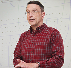
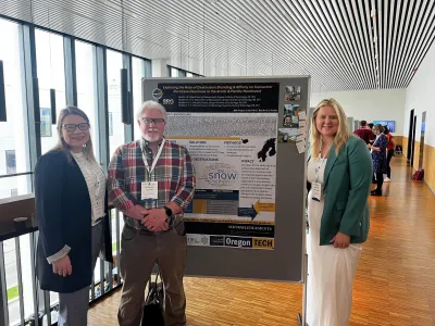
Featured in November 2016 by Oregon Tech for his research model built around community health, news of Geomatics professor Dr. John Ritter’s web mapping systems soon caught on to other news outlets. His research was featured by the Herald & News, KOTI-TV, 1859 Magazine, and picked up by many others, eventually leading to an invitation to serve as keynote speaker at the November 2017 Oregon Chapter of the American College of Physicians conference. The conference brought together nurses, doctors, physician’s assistants and other health care professionals to learn new and exciting things happening in medicine.

Dr. Ritter began his presentation by asking if the audience knew anything about Geographic Information Systems (GIS), to which very few responded in the affirmative. Through his GIS mapping project, Dr. Ritter was able to show how his system could be used to pinpoint areas of health care need, in this case within Klamath Falls. Through the analyses of a model of the walkability of local streets and area demographics to determine the relationship(s) between the presence of a disease, the mapping system was able to present the team with areas to identify within the community that would greatly benefit from remediation efforts.
The Klamath Falls City Council was in the process of creating a comprehensive trail plan for Klamath Falls and the unique analysis that Dr. Ritter was able to present with his analysis identified which areas would benefit most from construction of a downtown bike path. Combined with previous information that had been shared regarding the health benefits associated with more direct access to physical activity opportunities and active commuting, the plan helped the Council to move forward with the approval of an ‘Urban Trails Master Plan’ which could begin to reduce the incidence of obesity and diabetes within the region.
Dr. Ritter plans to complete the analysis again in a few years to map any differences. He also shared, “I think where we are at right now is to try to come to a better understanding of ‘why’ the specific disease categories are where they are in town. This could be a good launching point for PHM surveys.” PHM is the population health management program at Oregon Tech, which puts health research into practice, improving the well-being of communities. Program participants are already accustomed to collaborating with other entities through the PHM Research Center, which gives students opportunities to engage with the community and gain valuable, real-world experience. Oregon Tech Health Informatics and Health Care Management students could also help the group by building a dashboard that could make accessing data more retrievable.


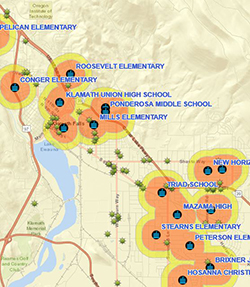
As a university that continues to broadcast the real, industry-experience that our faculty have, Dr. Ritter exhibits that through his private GIS consulting business, where he recently created a web mapping project for Klamath County Public Health to map the proximity of tobacco retailers to Klamath County schools: http://arcg.is/2kLSr1Q. All of the recent maps Dr. Ritter has compiled have also been added to the home page of the Healthy Klamath Coalition, a partnership of community members and agencies across many sections who focus on improving the health of Klamath County.
###
About Oregon Tech
Founded in Klamath Falls in 1947, Oregon Institute of Technology is the premier public polytechnic institution in the Pacific Northwest. Oregon Tech provides bachelor’s and master’s degree programs in engineering, health technologies, business, technology, communication, and applied sciences that prepare students to be effective participants in their professional, public and international communities through applied, relevant learning and professional practice. Oregon Tech has a full-service, residential campus in Klamath Falls; an urban, industry-focused campus in Portland-Metro (Wilsonville); an Online campus; and offers degrees at Boeing Seattle and at other sites. Visit www.oit.edu to learn more about Oregon Institute of Technology.
About Oregon Tech Geomatics
At Oregon Tech, the study of geomatics combines theory, problem-solving and field work to train students for an exciting career that fuses land surveying techniques with computer technology. The university offers two areas of focus within the degree, Surveying or Geographic Information Systems (GIS). GIS involves the creation and use of a "smart map" for addressing geospatial issues pertaining to the disciplines of archeology, urban planning, geomatics, health sciences, management, environmental sciences and many more.


