Ph.D., Civil Engineering, Oregon State University
M.S. Geomatics Engineering, University of New Brunswick
B.S. Surveying Engineering, University of Science & Technology
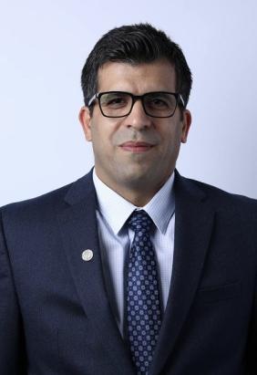
Dr. Mohsen Arjmand is an Assistant Professor in the Department of Applied Computing & Geomatics at Oregon Tech. He earned his Ph.D. from the School of Civil and Construction Engineering at Oregon State University (OSU), where his research focused on advancing sustainability in the built environment and construction industry using lidar technology. His work emphasizes concrete structures, leveraging 3D laser scanning and AI-driven methods to automate the post-processing of lidar data for on-site quality control, as well as robotic and automated surveying with advanced geomatics tools for progress monitoring.
Dr. Arjmand brings over 15 years of industry experience in construction, infrastructure, and surveying, primarily in British Columbia, Washington, and Ontario. He has led major concrete residential projects, successfully completing numerous high-rise developments and infrastructure works, including bridges and ramps, with expertise in both construction management and surveying oversight. At OSU, prior to joining OIT, he contributed to projects funded by USDOT, TRB, the National Cooperative Highway Research Program (NCHRP), Oregon DOT, and Oregon Parks and Recreation. His contributions included developing a Surveying and Mapping Guide for Transportation Projects (USDOT–TRB) in collaboration with Penn State and Washington State University, scanning historic structures at Silver Falls State Park, and conducting field campaigns on rock slope safety, coastal monitoring, and reinforced concrete quality assurance using terrestrial laser scanners and UAVs.
His teaching interests include geomatics and construction engineering, remote sensing, lidar and point-cloud processing, digital twins, and AI applications in construction and surveying informatics.
Dr. Arjmand is an active member of professional organizations, including ASCE, ASPRS, NSPS, and IEEE. He frequently serves as a reviewer for journals such as the ASCE Journal of Computing in Civil Engineering, the Journal of Surveying Engineering, and the Journal of Construction Engineering and Management. He has co-organized international CVPR workshops on computer vision in the built environment and led stakeholder engagement efforts for the TRB–NCHRP Survey Guide project. He continues to advance the integration of geomatics, robotics, and AI into construction engineering practice.

